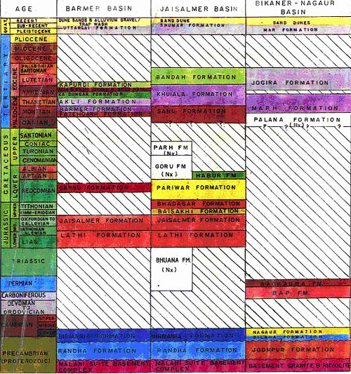
Uttarlai Fm
Period:
Quaternary
Age Interval:
Plio-Pleistocene.
Province:
NW.India Rajastan-Barmer Basin
Type Locality and Naming
Lithology and Thickness
"Miocene to recent deposits of the Jagardia Fm and Uttarlai Fm comprise continental alluvial deposits. Recent alluvium and stabilized eolian dunes complete the basin fill." (Najman et al., 2018, Tectonics 37: 3970-3985). On Dr. Raju's chart, the Uttarlai Fm is shown with chalk incursions near top.
Lithology Pattern:
Sandstone
Relationships and Distribution
Lower contact
Disconformity onto Kapurdi Fm on Dr. Raju's chart; conformity onto Jagardia Fm (late Miocene) on diagram of Najman et al., 2018.
Upper contact
Recent alluvial.
GeoJSON
{"type":"Feature","geometry":{"type":"MultiPolygon","coordinates":[[[[70.79,25.63],[71.05,26.35],[71.53,26.53],[71.72,26.19],[71.54,25.64],[70.79,25.63]]]]}}
Fossils
Age
Quaternary only on Dr. Raju's chart; but includes Pliocene on chart of Najman et al. (2018; Tectonics).
Age Span:
Beginning stage:
Gelasian
Fraction up in beginning stage:
0.0
Beginning date (Ma):
2.58
Ending stage:
Holocene
Fraction up in the ending stage:
1.0
Ending date (Ma):
0.00
Depositional setting
Alluvial
Depositional pattern:
Additional Information
Compiler:
